I've gone to LA. I jumped on a plane and headed over to sunny (rainy) California for a couple of weeks, to finish recording an album I started ages ago. More on that later, but the next few posts will be coming from a lovely seventies studio the other side of the pond
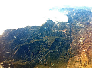
I love sitting by the window on the plane and seeing the world from space. I always see things that intrigue me, because things look so different form above. Here are some snaps I took over Canada and the western coast of America. Look at the bottom photos of the set. What are those weird grids? they are covering a massive area. I checked the location on the live flight map, then when I could I looked on google maps and found the area. Put 'Kearl Lake Canada' into google maps and look at the satellite view. Then pan down and right a bit, you will see the same thing I saw from the plane. What is it? I like things like that
UPDATE
heres some shots of LA on the way home:
Subscribe to:
Post Comments (Atom)


The grids in your last photo are roads. The land in much of the Midwest/Southwest was divided up as a result of the Homestead Act (see Wikipedia). When the grid is subdivided, it's been carved up beyond the original allotment. In your earlier photo showing the circles (radial irrigation machines), you can see the grid there too.
ReplyDelete